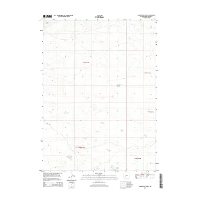
2015 Map of Black Rock North
USGS Topo · Published 2015About this map
Black Rock stands as a prominent landmark in this high-desert stretch of Sweetwater County, where the hydrology is defined by seasonal drainages and catchments. The landscape is carved by the Fourth of July Wash and Greasewood Wash, which channel intermittent runoff toward the southern reaches of the quadrangle. Human infrastructure is centered on water management and transit, notably at the Greasewood Reservoir and the reliable Black Rock Springs near the banks of Black Rock Cr. Mapping by the U.S. Geological Survey also details the sparse road network, including Chilton Rd and Cr-15, which provide the primary access through these expansive township sections. The map serves as a clear record of the area's arid character, punctuated only by these critical water sources and a few primitive travel routes.
Find a feature on this map
12 named features on this map. Tap any name to fly to it.
Don’t see what you’re looking for? This feature index may not catch every label — zoom into the map to look around manually.
Map Details
Editions of this 2015 Black Rock North Map
This is the sole edition of this map. No revisions or reprints were ever made.
Other maps of this area

1954 · Rock Springs
USGS Topo · 1:250,000

1955 · Lander
USGS Topo · 1:250,000

1958 · Lander
USGS Topo · 1:250,000

1958 · Rock Springs
USGS Topo · 1:250,000

1958 · Twelvemile Well
USGS Topo · 1:62,500

1958 · Freighter Gap
USGS Topo · 1:62,500

1958 · The Pinnacles
USGS Topo · 1:62,500

1958 · Superior
USGS Topo · 1:62,500

1961 · Lander
USGS Topo · 1:250,000

1962 · Rock Springs
USGS Topo · 1:250,000