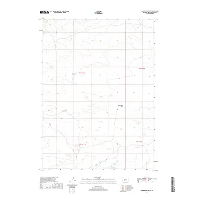
2017 Map of Black Rock North
USGS Topo · Published 2017About this map
Greasewood Reservoir sits at the heart of this high-desert landscape in Sweetwater County, serving as a vital water collection point in an arid region defined by seasonal drainages. The topography is shaped by the intermittent flows of Fourth of July Wash and Greasewood Wash, which carve subtle paths across the sagebrush-covered plains. Sparse infrastructure is represented by primitive routes like Chilton Rd and Co Rd 83, highlighting the isolation of the Red Desert area. Near the southern boundary, Black Rock Springs and the headwaters of Black Rock Cr provide rare reliable water sources in this stretch of the Wyoming backcountry, where the public land survey system remains the primary method for navigating the expansive open range.
Find a feature on this map
12 named features on this map. Tap any name to fly to it.
Don’t see what you’re looking for? This feature index may not catch every label — zoom into the map to look around manually.
Map Details
Editions of this 2017 Black Rock North Map
This is the sole edition of this map. No revisions or reprints were ever made.
Other maps of this area

1954 · Rock Springs
USGS Topo · 1:250,000

1955 · Lander
USGS Topo · 1:250,000

1958 · Lander
USGS Topo · 1:250,000

1958 · Rock Springs
USGS Topo · 1:250,000

1958 · Twelvemile Well
USGS Topo · 1:62,500

1958 · Freighter Gap
USGS Topo · 1:62,500

1958 · The Pinnacles
USGS Topo · 1:62,500

1958 · Superior
USGS Topo · 1:62,500

1961 · Lander
USGS Topo · 1:250,000

1962 · Rock Springs
USGS Topo · 1:250,000