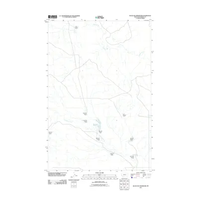
2011 Map of Black Sea Reservoir
USGS Topo · Published 2011About this map
Black Sea Reservoir and the intricate drainage of West Blacktail Creek define this rural landscape in Rosebud County. The map reveals a highly engineered watershed, marked by a dense system of earthen works managed for water storage in the arid Montana plains. Numerous private or regional water control structures, such as Big Timber Number 14 Dam and Big Timber Number 10 Dam, dot the tributary lines leading toward larger basins. These dams reflect the essential role of water management for local ranching and agricultural sustainability. To the north, McGinnis Creek meanders across the quadrangle, flanked by additional numbered improvements like the L Galt Number 20 Dam and Galt Number 22 Dam. This topographic survey provides a precise record of these water-related landmarks and the unimproved roads that connect them across the basin floor.
Find a feature on this map
13 named features on this map. Tap any name to fly to it.
Don’t see what you’re looking for? This feature index may not catch every label — zoom into the map to look around manually.
Map Details
Editions of this 2011 Black Sea Reservoir Map
This is the sole edition of this map. No revisions or reprints were ever made.
Other maps of this area

1954 · Forsyth
USGS Topo · 1:250,000

1957 · Forsyth
USGS Topo · 1:250,000

1958 · Forsyth
USGS Topo · 1:250,000

1960 · Hagen Ranch
USGS Topo · 1:24,000

1960 · Yablonski Ranch
USGS Topo · 1:24,000

1960 · Thebes
USGS Topo · 1:24,000

1960 · Ingomar West
USGS Topo · 1:24,000

1960 · Ingomar East
USGS Topo · 1:24,000

1960 · Black Sea Reservoir
USGS Topo · 1:24,000

1965 · Hole-In-The-Rock
USGS Topo · 1:24,000