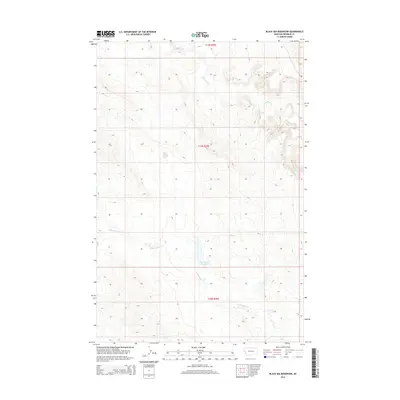
2014 Map of Black Sea Reservoir
USGS Topo · Published 2014About this map
Black Sea Reservoir sits at the heart of this Montana landscape in Rosebud County, serving as a primary water source in a region defined by its drainage basins. The area is characterized by the winding paths of McGinnis Cr to the north and W Blacktail Cr which moves through the southern sections. This 2014 survey reveals a territory organized by the Public Land Survey System, shown through the boundaries of t12n r35e, t11n r35e, and t10n r35e. The map illustrates the topographic relief of the plains, where subtle elevation changes guide the seasonal flow of creeks and the collection of water in the central reservoir.
Find a feature on this map
6 named features on this map. Tap any name to fly to it.
Don’t see what you’re looking for? This feature index may not catch every label — zoom into the map to look around manually.
Map Details
Editions of this 2014 Black Sea Reservoir Map
This is the sole edition of this map. No revisions or reprints were ever made.
Other maps of this area

1954 · Forsyth
USGS Topo · 1:250,000

1957 · Forsyth
USGS Topo · 1:250,000

1958 · Forsyth
USGS Topo · 1:250,000

1960 · Hagen Ranch
USGS Topo · 1:24,000

1960 · Yablonski Ranch
USGS Topo · 1:24,000

1960 · Thebes
USGS Topo · 1:24,000

1960 · Ingomar West
USGS Topo · 1:24,000

1960 · Ingomar East
USGS Topo · 1:24,000

1960 · Black Sea Reservoir
USGS Topo · 1:24,000

1965 · Hole-In-The-Rock
USGS Topo · 1:24,000