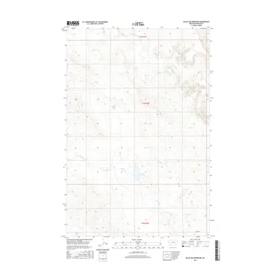
2017 Map of Black Sea Reservoir
USGS Topo · Published 2017About this map
Black Sea Reservoir and the drainage network of eastern Montana characterize this remote portion of Rosebud County as it appeared in the late 2010s. The landscape is defined by the ephemeral flows of McGinnis Cr in the north and the branching system of W Blacktail Cr that feeds the central reservoir. Situated within the township boundaries of t11n r35e, the area remains largely undeveloped, preserving the original Public Land Survey System grid. Transportation through this section of the plains is limited to Cohagen Rd in the southeast corner, which serves as the primary corridor for the sparse ranching and agricultural operations that utilize the surrounding water sources.
Find a feature on this map
7 named features on this map. Tap any name to fly to it.
Don’t see what you’re looking for? This feature index may not catch every label — zoom into the map to look around manually.
Map Details
Editions of this 2017 Black Sea Reservoir Map
This is the sole edition of this map. No revisions or reprints were ever made.
Other maps of this area

1954 · Forsyth
USGS Topo · 1:250,000

1957 · Forsyth
USGS Topo · 1:250,000

1958 · Forsyth
USGS Topo · 1:250,000

1960 · Hagen Ranch
USGS Topo · 1:24,000

1960 · Yablonski Ranch
USGS Topo · 1:24,000

1960 · Thebes
USGS Topo · 1:24,000

1960 · Ingomar West
USGS Topo · 1:24,000

1960 · Ingomar East
USGS Topo · 1:24,000

1960 · Black Sea Reservoir
USGS Topo · 1:24,000

1965 · Hole-In-The-Rock
USGS Topo · 1:24,000