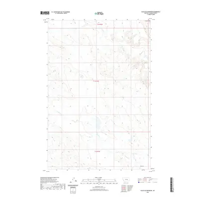
2020 Map of Black Sea Reservoir
USGS Topo · Published 2020About this map
McGinnis Cr and W Blacktail Cr define the drainage patterns of this Rosebud County landscape, illustrating a remote stretch of Montana high plains north of the Yellowstone River. The terrain is marked by the complex dissection of the northern plains, where intermittent watercourses have carved intricate coulees and ridges. Towards the southern edge of the survey, Cohagen Rd provides the primary transit corridor through this sparsely populated region. The map meticulously records the Public Land Survey System grid across townships t12n r35e, t11n r35e, and t10n r35e, showing the intersection of range lines that historically governed homesteading and ranching boundaries in this part of the state.
Find a feature on this map
7 named features on this map. Tap any name to fly to it.
Don’t see what you’re looking for? This feature index may not catch every label — zoom into the map to look around manually.
Map Details
Editions of this 2020 Black Sea Reservoir Map
This is the sole edition of this map. No revisions or reprints were ever made.
Other maps of this area

1954 · Forsyth
USGS Topo · 1:250,000

1957 · Forsyth
USGS Topo · 1:250,000

1958 · Forsyth
USGS Topo · 1:250,000

1960 · Hagen Ranch
USGS Topo · 1:24,000

1960 · Yablonski Ranch
USGS Topo · 1:24,000

1960 · Thebes
USGS Topo · 1:24,000

1960 · Ingomar West
USGS Topo · 1:24,000

1960 · Ingomar East
USGS Topo · 1:24,000

1960 · Black Sea Reservoir
USGS Topo · 1:24,000

1965 · Hole-In-The-Rock
USGS Topo · 1:24,000