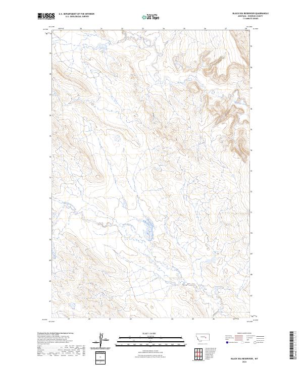
2024 Map of Black Sea Reservoir
USGS Topo · Published 2024About this map
The high plains of Rosebud County are defined by a network of drainage systems that carve through the Montana landscape. Water is the primary architect of this terrain, with Mcginnis Creek and West Blacktail Creek serving as the principal features of the drainage basin. These seasonal or ephemeral watercourses represent the critical landmarks in an otherwise sparse interior. The lone arterial route, Cohagen Rd, traverses the southern portion of the quadrangle, indicating the historic transit patterns for ranching and local commerce in this part of the state. Surveyed within township boundaries including T12N R35E and T10N R35E, the map illustrates the persistence of the Public Land Survey System in organizing this rural expanse, where topography and natural waterways dictate the layout of roads and ranch access.
Find a feature on this map
8 named features on this map. Tap any name to fly to it.
Don’t see what you’re looking for? This feature index may not catch every label — zoom into the map to look around manually.
Map Details
Editions of this 2024 Black Sea Reservoir Map
This is the sole edition of this map. No revisions or reprints were ever made.
Other maps of this area

1954 · Forsyth
USGS Topo · 1:250,000

1957 · Forsyth
USGS Topo · 1:250,000

1958 · Forsyth
USGS Topo · 1:250,000

1960 · Hagen Ranch
USGS Topo · 1:24,000

1960 · Yablonski Ranch
USGS Topo · 1:24,000

1960 · Thebes
USGS Topo · 1:24,000

1960 · Ingomar West
USGS Topo · 1:24,000

1960 · Ingomar East
USGS Topo · 1:24,000

1960 · Black Sea Reservoir
USGS Topo · 1:24,000

1965 · Hole-In-The-Rock
USGS Topo · 1:24,000