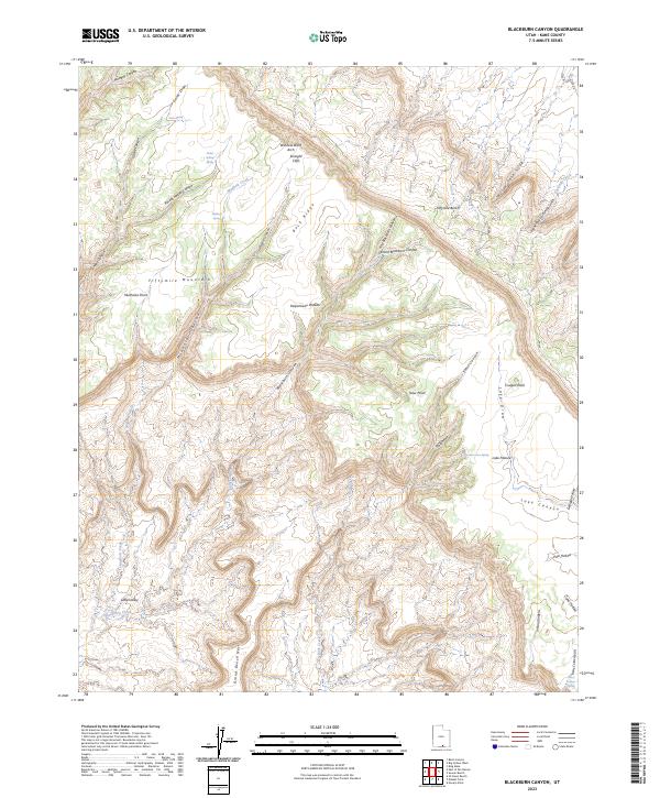
2023 Map of Blackburn Canyon
USGS Topo · Published 2023About this map
Kaiparowits Plateau and the surrounding high desert topography dominate this 2023 survey of Kane County. The landscape is defined by its dramatic relief, from the heights of Fiftymile Mountain down into the intricate drainage systems of Blackburn Canyon and Llewellyn Canyon. Settlement is absent in this arid stretch of Utah, but the presence of vital water sources like Gates Spring, Mudhole Spring, and Harry Colves Spring indicates the critical landmarks used by ranchers and travelers in the region. The map highlights the significant north-south passage along the Hole In The Rock Rd, a route steeped in the history of the San Juan Mission. Notable geologic and cultural features such as Window Wind Arch, Indian Gardens, and the Straight Cliffs reveal a terrain where every named spring and canyon served as a fundamental navigational anchor.
Find a feature on this map
43 named features on this map. Tap any name to fly to it.
Don’t see what you’re looking for? This feature index may not catch every label — zoom into the map to look around manually.
Map Details
Editions of this 2023 Blackburn Canyon Map
This is the sole edition of this map. No revisions or reprints were ever made.
Other maps of this area

1886 · Escalante
USGS Topo · 1:250,000

1922 · Warm Creek
USGS Topo · 1:63,360

1922 · Rees Canyon
USGS Topo · 1:63,360

1953 · Cummings Mesa
USGS Topo · 1:62,500

1953 · Gunsight Butte
USGS Topo · 1:62,500

1956 · Escalante
USGS Topo · 1:250,000

1960 · Escalante
USGS Topo · 1:250,000

1968 · East of The Navajo
USGS Topo · 1:24,000
1968 · Big Hollow Wash
USGS Topo · 1:24,000
1968 · Basin Canyon
USGS Topo · 1:24,000