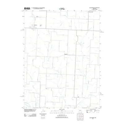
2012 Map of Blackburn
USGS Topo · Published 2012About this map
Mount Leonard and the village of Blackburn anchor this northern Saline County landscape, where the agricultural grid is defined by a dense network of country roads. The terrain is characterized by the branching drainages of Jordan Creek, Salt Pond Creek, and Brushy Creek, which carve gentle valleys through the prairie farmland. For genealogists, the presence of Blackburn Cemetery, Allen Cemetery, and Gross Cemetery provides specific points of interest for tracing family roots within this rural community. The map also captures local water management and recreation at Stoll Lake and the Blackburn Pond Dam. A distinctive topographical feature is the Old Channel Davis Creek, showing the natural shift of watercourses in this part of Missouri. The landscape is primarily divided by county routes such as Co HWY-301 and Liter RD, illustrating the persistent rural infrastructure connecting these small settlements.
Find a feature on this map
40 named features on this map. Tap any name to fly to it.
Don’t see what you’re looking for? This feature index may not catch every label — zoom into the map to look around manually.
Map Details
Editions of this 2012 Blackburn Map
This is the sole edition of this map. No revisions or reprints were ever made.
Other maps of this area

1885 · Warrensburg
USGS Topo · 1:125,000

1887 · Sedalia
USGS Topo · 1:125,000

1887 · Warrensburg
USGS Topo · 1:125,000

1889 · Lexington
USGS Topo · 1:125,000

1890 · Marshall
USGS Topo · 1:125,000

1892 · Marshall
USGS Topo · 1:125,000

1894 · Sedalia
USGS Topo · 1:125,000

1894 · Warrensburg
USGS Topo · 1:125,000

1901 · Marshall
USGS Topo · 1:125,000

1917 · Knobnoster
USGS Topo · 1:62,500