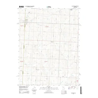
2015 Map of Blackburn
USGS Topo · Published 2015About this map
Blackburn sits at the intersection of Lafayette and Saline counties, serving as a focal point for this rural agricultural landscape in the mid-2010s. The town is surrounded by a network of local roads including N Main St and S Main St, with nearby water features like Stoll Lake and Blackburn Pond providing local landmarks. The terrain is defined by a dense system of creek branches, most notably Salt Pond Cr and its tributaries, which carve through the farmland. Genealogy researchers will find several well-documented burial sites across the township, including Blackburn Cemetery to the north and Allen Cemetery and Gross Cemetery further south. Small settlements like Mount Leonard and Elmwood anchor the eastern portions of the map, connected by a grid of named rural routes such as Boulder Ave and Arcadia Ave.
Find a feature on this map
61 named features on this map. Tap any name to fly to it.
Don’t see what you’re looking for? This feature index may not catch every label — zoom into the map to look around manually.
Map Details
Editions of this 2015 Blackburn Map
This is the sole edition of this map. No revisions or reprints were ever made.
Other maps of this area

1885 · Warrensburg
USGS Topo · 1:125,000

1887 · Sedalia
USGS Topo · 1:125,000

1887 · Warrensburg
USGS Topo · 1:125,000

1889 · Lexington
USGS Topo · 1:125,000

1890 · Marshall
USGS Topo · 1:125,000

1892 · Marshall
USGS Topo · 1:125,000

1894 · Sedalia
USGS Topo · 1:125,000

1894 · Warrensburg
USGS Topo · 1:125,000

1901 · Marshall
USGS Topo · 1:125,000

1917 · Knobnoster
USGS Topo · 1:62,500