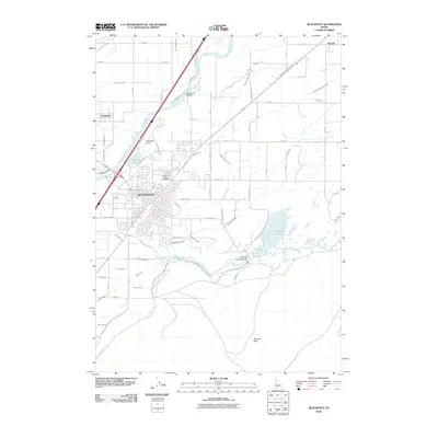
2010 Map of Blackfoot
USGS Topo · Published 2010About this map
The Blackfoot urban area and its surrounding agricultural landscape are defined by a complex network of irrigation and river engineering at the confluence of the Snake River and the Blackfoot River. This 2010 survey highlights the importance of water management in the region, featuring the Blackfoot-Equalizing Dam and the Equalizing Reservoir, which feed a labyrinth of waterways such as the Fort Hall Main Canal, Little Butte Canal, and Corbett Slough Canal. These engineering works transformed the high desert into a productive valley, supporting nearby settlements like Wapello and Groveland.
Find a feature on this map
70 named features on this map. Tap any name to fly to it.
Don’t see what you’re looking for? This feature index may not catch every label — zoom into the map to look around manually.
Map Details
Editions of this 2010 Blackfoot Map
This is the sole edition of this map. No revisions or reprints were ever made.
Other maps of this area

1940 · Blackfoot
USGS Topo · 1:62,500

1943 · Blackfoot
USGS Topo · 1:62,500

1955 · Baldy Knoll
USGS Topo · 1:24,000

1955 · Lincoln Creek
USGS Topo · 1:24,000

1955 · Rose
USGS Topo · 1:24,000

1955 · Firth
USGS Topo · 1:24,000

1955 · Yandell Springs
USGS Topo · 1:62,500

1955 · Idaho Falls
USGS Topo · 1:250,000

1958 · Idaho Falls
USGS Topo · 1:250,000
1971 · Fort Hall
USGS Topo · 1:24,000