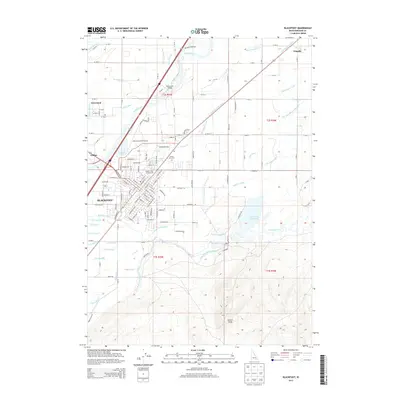
2013 Map of Blackfoot
USGS Topo · Published 2013About this map
Blackfoot serves as the focal point of this Eastern Idaho landscape, situated where the Blackfoot River joins the Snake River. The map illustrates a complex hydraulic network essential to regional agriculture, featuring dozens of named waterworks such as the Corbett Slough Canal, Riverside Canal, and the Fort Hall Main Canal. These systems trace the transition from the river bottomlands to the higher elevation marked by Stevens Peak in the southeast.
Find a feature on this map
103 named features on this map. Tap any name to fly to it.
Don’t see what you’re looking for? This feature index may not catch every label — zoom into the map to look around manually.
Map Details
Editions of this 2013 Blackfoot Map
This is the sole edition of this map. No revisions or reprints were ever made.
Other maps of this area

1940 · Blackfoot
USGS Topo · 1:62,500

1943 · Blackfoot
USGS Topo · 1:62,500

1955 · Baldy Knoll
USGS Topo · 1:24,000

1955 · Lincoln Creek
USGS Topo · 1:24,000

1955 · Rose
USGS Topo · 1:24,000

1955 · Firth
USGS Topo · 1:24,000

1955 · Yandell Springs
USGS Topo · 1:62,500

1955 · Idaho Falls
USGS Topo · 1:250,000

1958 · Idaho Falls
USGS Topo · 1:250,000
1971 · Fort Hall
USGS Topo · 1:24,000