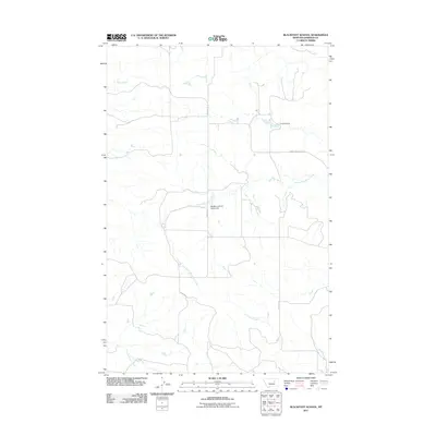
2011 Map of Blackfoot School
USGS Topo · Published 2011About this map
Blackfoot School (Historical) stands as a point of interest in this central Garfield County landscape, located along the path of Brusett Rd. The area is characterized by a network of drainage systems, most notably Seven Blackfoot Creek, which winds through the central portion of the quadrangle. Local ranching history is anchored by the Freemen Ranch, while the surrounding terrain is etched by Indian Creek, Lone Tree Creek, and Nancy Russell Creek. The presence of the Loomis and Clark Trl and Merlack Rd indicates the established routes used for movement through this part of Montana's open plains. This survey reflects the sparse, rural nature of the region, where a single historical schoolhouse serves as a primary marker for local genealogy and settlement history.
Find a feature on this map
9 named features on this map. Tap any name to fly to it.
Don’t see what you’re looking for? This feature index may not catch every label — zoom into the map to look around manually.
Map Details
Editions of this 2011 Blackfoot School Map
This is the sole edition of this map. No revisions or reprints were ever made.
Other maps of this area

1954 · Jordan
USGS Topo · 1:250,000

1956 · Jordan
USGS Topo · 1:250,000

1958 · Jordan
USGS Topo · 1:250,000

1964 · Jordan
USGS Topo · 1:250,000

1965 · Spring Creek School
USGS Topo · 1:24,000

1965 · Pine Grove School
USGS Topo · 1:24,000
1967 · Hay Coulee
USGS Topo · 1:24,000

1971 · Sawmill Creek
USGS Topo · 1:24,000

1971 · Chalk Butte
USGS Topo · 1:24,000

1978 · Fort Peck Lake West
USGS Topo · 1:100,000