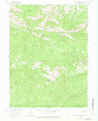
1961 Map of Blackhall Mountain
USGS Topo · Published 1972About this map
Blackhall Mountain serves as the high-elevation center of this high-altitude landscape where the State Line divides the Medicine Bow National Forest in Wyoming from the Routt National Forest in Colorado. Surveyed in the early 1960s, the map reveals a wilderness shaped by drainage patterns and remote access, with water flowing from the slopes into the East Encampment River and North Fork Big Creek.
Find a feature on this map
29 named features on this map. Tap any name to fly to it.
Don’t see what you’re looking for? This feature index may not catch every label — zoom into the map to look around manually.
Map Details
Editions of this 1961 Blackhall Mountain Map
4 editions found
Other maps of this area

1911 · Hahns Peak
USGS Topo · 1:125,000

1913 · Hahns Peak
USGS Topo · 1:125,000

1939 · Saratoga
USGS Topo · 1:125,000

1954 · Rawlins
USGS Topo · 1:250,000

1954 · Craig
USGS Topo · 1:250,000

1955 · Davis Peak
USGS Topo · 1:24,000

1955 · Pearl
USGS Topo · 1:24,000

1956 · Pearl
USGS Topo · 1:62,500

1957 · Craig
USGS Topo · 1:250,000

1958 · Rawlins
USGS Topo · 1:250,000