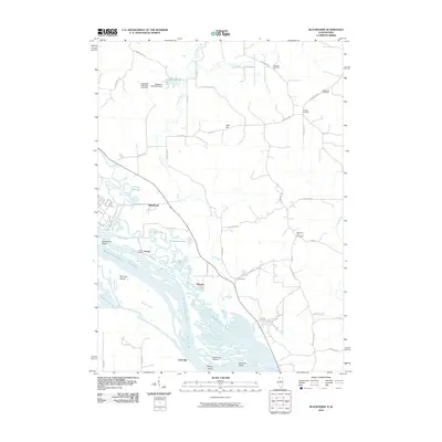
2010 Map of Blackhawk
USGS Topo · Published 2010About this map
The Mississippi River dominates the western edge of this landscape, carving a complex network of backwaters and islands including Apple River Island and Railroad Island. This 2010 survey reveals a riverine economy where the Apple River meets the main channel near Arnold Landing and the small settlement of Blackhawk. Inland, the terrain is defined by the winding course of Rush Creek and numerous family-named roads that suggest a deep-rooted agricultural community. Genealogists will find significant value in the distribution of rural burial grounds, such as Morrison Cemetery and Massbach Cemetery, which are scattered among the ridges and hills like Heer Hill. The southern reach of the quadrangle shows the river widening into Buffalo Lake near Lainsville, highlighting the shifting hydrologic boundary between Illinois and Iowa. This document captures the intersection of major water transport routes and the quiet, upland townships of Jo Daviess County.
Find a feature on this map
56 named features on this map. Tap any name to fly to it.
Don’t see what you’re looking for? This feature index may not catch every label — zoom into the map to look around manually.
Map Details
Editions of this 2010 Blackhawk Map
This is the sole edition of this map. No revisions or reprints were ever made.
Other maps of this area

1892 · Savanna
USGS Topo · 1:62,500

1911 · Elizabeth
USGS Topo · 1:62,500

1911 · Galena
USGS Topo · 1:62,500

1913 · Galena
USGS Topo · 1:62,500

1935 · Miles
USGS Topo · 1:62,500

1936 · Elizabeth
USGS Topo · 1:62,500

1941 · Miles
USGS Topo · 1:62,500

1952 · Savanna
USGS Topo · 1:62,500

1953 · Blackhawk
USGS Topo · 1:24,000

1953 · Green Island
USGS Topo · 1:24,000