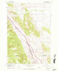
1953 Map of Blackhawk
USGS Topo · Published 1972About this map
Black Hills National Forest defines the western landscape of this mid-century survey, where the rising terrain of the Black Hills meets the eastern plains. The corridor follows the Chicago and North Western railroad line, which skirts the base of prominent landmarks like Piedmont Butte and the Petrified Forest. This era shows Blackhawk as a growing hub along the rail line, anchored by local institutions such as the Blackhawk Cem and nearby Evergreen Sch.
Find a feature on this map
25 named features on this map. Tap any name to fly to it.
Don’t see what you’re looking for? This feature index may not catch every label — zoom into the map to look around manually.
Map Details
Editions of this 1953 Blackhawk Map
4 editions found
Other maps of this area

1893 · Rapid
USGS Topo · 1:125,000

1898 · Rapid
USGS Topo · 1:125,000

1903 · Rapid
USGS Topo · 1:125,000

1953 · Rapid City 1 SW
USGS Topo · 1:24,000

1953 · Blackhawk
USGS Topo · 1:24,000

1953 · Rapid City East
USGS Topo · 1:24,000

1953 · Piedmont
USGS Topo · 1:24,000

1953 · Rapid City NW
USGS Topo · 1:24,000

1953 · Rapid City West
USGS Topo · 1:24,000
1953 · Tilford
USGS Topo · 1:24,000