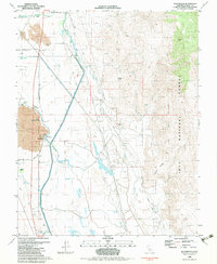
1982 Map of Blackrock
USGS Topo · Published 1983About this map
Lava flows and alluvial fans define the western Owens Valley landscape, where the Los Angeles Aqueduct and Owens River run parallel courses through the basin. This 1982 map highlights a complex hydraulic environment, featuring the Black Rock Fish Hatchery and several springs like Little Blackrock Spring and Black Rock Springs that emerge at the edge of the volcanic fields. To the east, the terrain rises into the Inyo National Forest along Crystal Ridge. Historical mining activity is evident at the Black Jack Mine and Jack Black Mine, while ranching history is marked by Taboose Ranch and Eightmile Ranch. The Old Railroad Grade and Aberdeen Station Road provide evidence of earlier transportation networks that once served this corridor between the Sierra Nevada and the White-Inyo mountains.
Find a feature on this map
30 named features on this map. Tap any name to fly to it.
Don’t see what you’re looking for? This feature index may not catch every label — zoom into the map to look around manually.
Map Details
Editions of this 1982 Blackrock Map
2 editions found
Other maps of this area

1907 · Mt. Whitney
USGS Topo · 1:125,000

1913 · Bishop
USGS Topo · 1:125,000

1919 · Mt. Whitney
USGS Topo · 1:125,000

1937 · Mt. Whitney
USGS Topo · 1:125,000

1947 · Mariposa
USGS Topo · 1:250,000

1948 · Fresno
USGS Topo · 1:250,000

1948 · Mariposa
USGS Topo · 1:250,000

1950 · Big Pine
USGS Topo · 1:62,500

1951 · Waucoba Mtn.
USGS Topo · 1:62,500

1951 · Independence
USGS Topo · 1:62,500