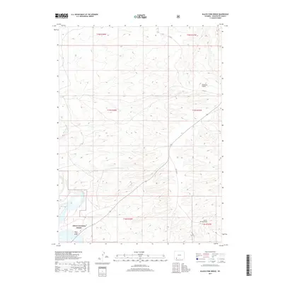
2017 Map of Blacks Fork Bridge
USGS Topo · Published 2017About this map
Ashley National Forest borders the southwestern reaches of this Wyoming landscape, where the Blacks Fork river weaves through the terrain. The map centers on the crossing at Blacks Fork Bridge, a critical point of orientation in an area defined by its drainage systems and canyons. Rugged landforms such as Telephone Canyon and the Chicke Springs Draw illustrate the complex topography typical of Sweetwater County's high desert environment.
Find a feature on this map
13 named features on this map. Tap any name to fly to it.
Don’t see what you’re looking for? This feature index may not catch every label — zoom into the map to look around manually.
Map Details
Editions of this 2017 Blacks Fork Bridge Map
This is the sole edition of this map. No revisions or reprints were ever made.
Other maps of this area

1954 · Rock Springs
USGS Topo · 1:250,000

1957 · Mc Kinnon Junction
USGS Topo · 1:62,500

1957 · Firehole Basin
USGS Topo · 1:62,500

1958 · Rock Springs
USGS Topo · 1:250,000

1961 · Peru
USGS Topo · 1:24,000

1961 · Green River
USGS Topo · 1:24,000

1961 · Bryan
USGS Topo · 1:24,000

1962 · Rock Springs
USGS Topo · 1:250,000

1966 · Firehole Basin
USGS Topo · 1:62,500

1966 · Mc Kinnon Junction
USGS Topo · 1:62,500