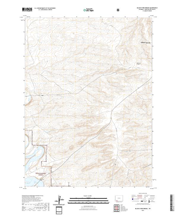
2021 Map of Blacks Fork Bridge
USGS Topo · Published 2021About this map
Ashley National Forest occupies the southwestern corner of this landscape, where the namesake Blacks Fork Bridge crosses the winding course of the Blacks Fork. The terrain is defined by its drainage patterns, with Big Dry Creek feeding into the main fork from the south while Telephone Canyon and Chicken Springs Draw carve distinct paths through the high plateaus and breaks.
Find a feature on this map
15 named features on this map. Tap any name to fly to it.
Don’t see what you’re looking for? This feature index may not catch every label — zoom into the map to look around manually.
Map Details
Editions of this 2021 Blacks Fork Bridge Map
This is the sole edition of this map. No revisions or reprints were ever made.
Other maps of this area

1954 · Rock Springs
USGS Topo · 1:250,000

1957 · Mc Kinnon Junction
USGS Topo · 1:62,500

1957 · Firehole Basin
USGS Topo · 1:62,500

1958 · Rock Springs
USGS Topo · 1:250,000

1961 · Peru
USGS Topo · 1:24,000

1961 · Green River
USGS Topo · 1:24,000

1961 · Bryan
USGS Topo · 1:24,000

1962 · Rock Springs
USGS Topo · 1:250,000

1966 · Firehole Basin
USGS Topo · 1:62,500

1966 · Mc Kinnon Junction
USGS Topo · 1:62,500