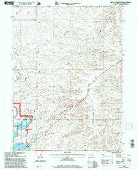
1996 Map of Blacks Fork Bridge
USGS Topo · Published 1999About this map
Flaming Gorge Reservoir dominates the southwestern corner of this survey, where the waters of the Blacks Fork are contained within the high desert landscape of Sweetwater County. The map documents a rugged intersection of public lands, primarily the Ashley National Forest and the Flaming Gorge National Recreation Area. These federal designations protect a terrain marked by deep erosional features like Chicken Springs Draw and various unnamed canyons, while the Fourth Standard Parallel North serves as a primary cadastral reference across the midsection of the sheet.
Find a feature on this map
16 named features on this map. Tap any name to fly to it.
Don’t see what you’re looking for? This feature index may not catch every label — zoom into the map to look around manually.
Map Details
Editions of this 1996 Blacks Fork Bridge Map
This is the sole edition of this map. No revisions or reprints were ever made.
Other maps of this area

1954 · Rock Springs
USGS Topo · 1:250,000

1957 · Mc Kinnon Junction
USGS Topo · 1:62,500

1957 · Firehole Basin
USGS Topo · 1:62,500

1958 · Rock Springs
USGS Topo · 1:250,000

1961 · Peru
USGS Topo · 1:24,000

1961 · Green River
USGS Topo · 1:24,000

1961 · Bryan
USGS Topo · 1:24,000

1962 · Rock Springs
USGS Topo · 1:250,000

1966 · Firehole Basin
USGS Topo · 1:62,500

1966 · Mc Kinnon Junction
USGS Topo · 1:62,500