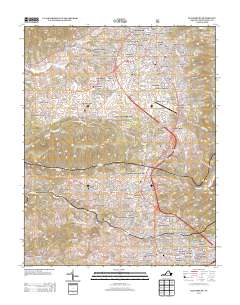
2013 Map of Blacksburg
USGS Topo · Published 2013About this map
The town of Blacksburg and its academic expansion dominate this 2013 survey of Montgomery County. The landscape is defined by the significant footprint of the Virginia Polytechnic Institute and State University Horticultural Research Area and the Virginia Tech/Montgomery Executive Airport, illustrating the university's role in local land use. Residential developments like McBryde Village, Sundance Village, and Dundas Heights show the modern suburban density surrounding the campus, while older landmarks such as Kanodes Mill on Toms Cr hint at the area's milling history.
Find a feature on this map
144 named features on this map. Tap any name to fly to it.
Don’t see what you’re looking for? This feature index may not catch every label — zoom into the map to look around manually.
Map Details
Editions of this 2013 Blacksburg Map
This is the sole edition of this map. No revisions or reprints were ever made.
Other maps of this area

1890 · Dublin
USGS Topo · 1:125,000

1890 · Christiansburg
USGS Topo · 1:125,000

1891 · Dublin
USGS Topo · 1:125,000

1923 · Pearisburg
USGS Topo · 1:62,500

1923 · Waiteville
USGS Topo · 1:62,500

1931 · Waiteville
USGS Topo · 1:48,000

1932 · Pearisburg
USGS Topo · 1:48,000

1932 · Blacksburg
USGS Topo · 1:48,000

1937 · Pearisburg
USGS Topo · 1:62,500

1937 · Blacksburg
USGS Topo · 1:62,500