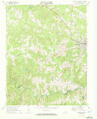
1968 Map of Blackstone West
USGS Topo · Published 1972About this map
Blackstone serves as the primary urban center for this Southside Virginia landscape, positioned along the Norfolk and Western railroad corridor. The surrounding terrain is defined by a dense network of tributaries including Horsepen Creek, Whetstone Creek, and Cellar Creek, which feed into the Little Nottoway River. The map highlights the significant southern presence of the Camp Pickett Military Reservation bordering the Nottoway River, marking a distinct boundary between civilian settlement and military use.
Find a feature on this map
27 named features on this map. Tap any name to fly to it.
Don’t see what you’re looking for? This feature index may not catch every label — zoom into the map to look around manually.
Map Details
Editions of this 1968 Blackstone West Map
Other maps of this area

1891 · Farmville
USGS Topo · 1:125,000

1893 · Farmville
USGS Topo · 1:125,000

1897 · Amelia
USGS Topo · 1:125,000

1918 · Lawrenceville
USGS Topo · 1:62,500

1920 · Lawrenceville
USGS Topo · 1:48,000

1921 · Lawrenceville
USGS Topo · 1:62,500

1942 · Lawrenceville
USGS Topo · 1:62,500

1943 · Richmond
USGS Topo · 1:250,000

1947 · Roanoke
USGS Topo · 1:250,000

1949 · Richmond
USGS Topo · 1:250,000