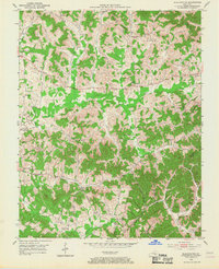
1952 Map of Blackwater
USGS Topo · Published 1967About this map
The Wilderness Road and Robinson Road cut through the heavily wooded terrain of Laurel and Clay counties, following the natural corridors formed by the Laurel River and Blackwater Creek. During the early 1950s, this region was defined by a dense network of small family-named settlements and rural institutions. Significant clusters of community life are centered around Lida, Bush, and Blackwater, where local schools like Camp Ground Sch and Weaver Sch served the surrounding farmsteads.
Find a feature on this map
68 named features on this map. Tap any name to fly to it.
Don’t see what you’re looking for? This feature index may not catch every label — zoom into the map to look around manually.
Map Details
Editions of this 1952 Blackwater Map
2 editions found

Other maps of this area

1886 · Cumberland Gap
USGS Topo · 1:125,000

1888 · Cumberland Gap
USGS Topo · 1:125,000

1890 · Williamsburg
USGS Topo · 1:125,000

1891 · Manchester
USGS Topo · 1:125,000

1891 · Cumberland Gap
USGS Topo · 1:125,000

1893 · London
USGS Topo · 1:125,000

1894 · Williamsburg
USGS Topo · 1:125,000

1897 · London
USGS Topo · 1:125,000

1952 · Portersburg
USGS Topo · 1:24,000

1952 · Corbin
USGS Topo · 1:24,000