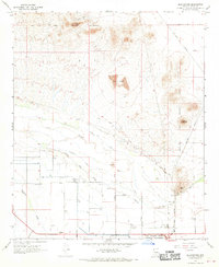
1966 Map of Blackwater
USGS Topo · Published 1970About this map
The Gila River Indian Reservation Boundary defines the northern and central portions of this 1966 survey, framing the settlement of Blackwater. The landscape is dominated by the seasonal course of the Gila River and its tributary, Little Blackwater, alongside the dry reach of McClellan Wash. These watercourses are flanked by an extensive network of irrigation infrastructure, including the North Side Canal and Pima Lateral, which supported agricultural development in the arid basin.
Find a feature on this map
35 named features on this map. Tap any name to fly to it.
Don’t see what you’re looking for? This feature index may not catch every label — zoom into the map to look around manually.
Map Details
Editions of this 1966 Blackwater Map
2 editions found
Other maps of this area

1900 · Florence
USGS Topo · 1:125,000

1902 · Florence
USGS Topo · 1:125,000

1907 · Sacaton
USGS Topo · 1:62,500

1922 · Red Rock No 2
USGS Topo · 1:48,000

1922 · Signal Peak
USGS Topo · 1:62,500

1924 · Signal Peak
USGS Topo · 1:62,500

1934 · Newman Peak
USGS Topo · 1:125,000

1954 · Mesa
USGS Topo · 1:250,000

1956 · Sacaton NE
USGS Topo · 1:24,000

1956 · Magma
USGS Topo · 1:24,000