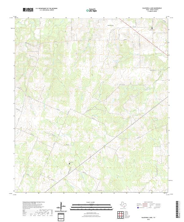
2022 Map of Blackwell Lake
USGS Topo · Published 2022About this map
Mustang Mott rises above the rolling ranchlands and creek bottoms of northern DeWitt County, anchoring a landscape defined by an intricate network of waterways including Shiloh Cr, Cottonwood Cr, and Blackjack Cr. This 2022 survey captures the rural character of the region, where family-named roads such as Dubose Ranch Rd and Smith Ranch Rd weave between large parcels of land. The map offers significant value for genealogists, documenting the location of local burial sites like the Lindenau Community Cem and Woods Cem, which serve as quiet landmarks for the area's agricultural history. Small bodies of water like Blackwell Lake and seasonal streams like Fivemile Cr drain toward the southwest, illustrating the natural topography that has dictated local settlement and road placement for generations.
Find a feature on this map
42 named features on this map. Tap any name to fly to it.
Don’t see what you’re looking for? This feature index may not catch every label — zoom into the map to look around manually.
Map Details
Editions of this 2022 Blackwell Lake Map
This is the sole edition of this map. No revisions or reprints were ever made.
Other maps of this area

1920 · Smiley
USGS Topo · 1:125,000

1953 · Beeville
USGS Topo · 1:250,000

1953 · Seguin
USGS Topo · 1:250,000

1956 · Beeville
USGS Topo · 1:250,000

1958 · Seguin
USGS Topo · 1:250,000

1960 · Beeville
USGS Topo · 1:250,000

1960 · Cuero
USGS Topo · 1:24,000

1960 · Concrete
USGS Topo · 1:24,000

1960 · Blackwell Lake
USGS Topo · 1:24,000

1960 · Westhoff
USGS Topo · 1:24,000