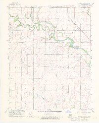
1968 Map of Blackwell NW
USGS Topo · Published 1970About this map
The Chikaskia River winds across the Kansas-Oklahoma border in this late 1960s survey, marking a landscape defined by both agriculture and early petroleum extraction. In Kay County, the Webb North Oil Field indicates the industrial footprint of the region, complemented by scattered Oil Wells and a Gas Well near the northern boundary. Settlement is concentrated around the community of Hunnewell, while the Atchison Topeka and Santa Fe railroad provides a primary transit corridor through the river valley. Local life is anchored by landmarks such as Asbury Ch and the Triumph Cem. The terrain is characterized by the prominent Bluff and the hydraulic features of Rock Falls, while recreational or social spaces like Lake Blackwell and the Camp of the Cross suggest the area's role beyond production and transit.
Find a feature on this map
21 named features on this map. Tap any name to fly to it.
Don’t see what you’re looking for? This feature index may not catch every label — zoom into the map to look around manually.
Map Details
Editions of this 1968 Blackwell NW Map
2 editions found

Other maps of this area

1889 · Caldwell
USGS Topo · 1:125,000

1890 · Wellington
USGS Topo · 1:125,000

1893 · Caldwell
USGS Topo · 1:125,000

1897 · Caldwell
USGS Topo · 1:125,000

1955 · Wichita
USGS Topo · 1:250,000

1955 · Enid
USGS Topo · 1:250,000

1958 · Enid
USGS Topo · 1:250,000

1958 · Wichita
USGS Topo · 1:250,000

1965 · Portland
USGS Topo · 1:24,000

1965 · South Haven
USGS Topo · 1:24,000