
1918 Map of Bladen
USGS Topo · Published 1918About this map
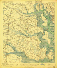
The Satilla River and Turtle River define the intricate marshland geography of Glynn and Camden Counties in this 1917 survey. The landscape is a network of tidal creeks and named islands such as Colonels Island, Blythe Island, and Gowrie Island. The era's transportation infrastructure is clearly delineated, showing the intersection of the Atlantic Coast Line, Seaboard Air Line, and Southern Ry railroads at key junctions like Bladen and Southern Junc.
Find a feature on this map
75 named features on this map. Tap any name to fly to it.
Don’t see what you’re looking for? This feature index may not catch every label — zoom into the map to look around manually.
Map Details
Editions of this 1918 Bladen Map
2 editions found
Other maps of this area

1917 · Nahunta
USGS Topo · 1:62,500

1917 · Boulogne
USGS Topo · 1:62,500

1918 · Cumberland Island
USGS Topo · 1:62,500

1918 · Hortense
USGS Topo · 1:62,500

1918 · Everett City
USGS Topo · 1:62,500

1918 · Nahunta
USGS Topo · 1:62,500

1918 · Kingsland
USGS Topo · 1:62,500

1919 · Boulogne
USGS Topo · 1:62,500

1920 · Everett City
USGS Topo · 1:62,500

1921 · Darien
USGS Topo · 1:62,500