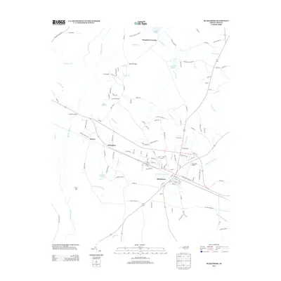
2013 Map of Bladenboro
USGS Topo · Published 2013About this map
Bladenboro serves as the focal point of this coastal plain landscape, where a sophisticated network of drainage and water management defines the local geography. The area is marked by numerous man-made and natural waterways, including the extensive Bryant Swamp Canal, Big Swamp Canal, and Marsh Canal, which interlace with the low-lying terrain. These systems historically supported the local economy, evidenced by several former mill sites such as Hester Millpond, Bridger Millpond, and Nance Millpond.
Find a feature on this map
125 named features on this map. Tap any name to fly to it.
Don’t see what you’re looking for? This feature index may not catch every label — zoom into the map to look around manually.
Map Details
Editions of this 2013 Bladenboro Map
This is the sole edition of this map. No revisions or reprints were ever made.
Other maps of this area

1953 · Chadbourn
USGS Topo · 1:62,500

1953 · Florence
USGS Topo · 1:250,000

1954 · Florence
USGS Topo · 1:250,000

1955 · Whiteville
USGS Topo · 1:62,500

1955 · Elizabethtown
USGS Topo · 1:62,500

1957 · Bladenboro
USGS Topo · 1:62,500

1982 · Elizabethtown
USGS Topo · 1:100,000

1986 · Whiteville
USGS Topo · 1:100,000

1986 · Tar Heel
USGS Topo · 1:24,000
1986 · Evergreen
USGS Topo · 1:24,000