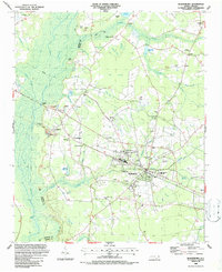
1986 Map of Bladenboro
USGS Topo · Published 1987About this map
Bladenboro serves as the hub for this section of the coastal plain, where the landscape is defined by a dense network of blackwater swamps and elliptical Carolina bays. The town layout is shaped by the CSX railroad corridor and local education centers like Spaulding Monroe Middle School. The surrounding countryside is dotted with family-named water features and historical landmarks, such as Hester Millpond, Singletary Millpond, and Bridger Millpond, which hint at a long-standing reliance on local milling.
Find a feature on this map
74 named features on this map. Tap any name to fly to it.
Don’t see what you’re looking for? This feature index may not catch every label — zoom into the map to look around manually.
Map Details
Editions of this 1986 Bladenboro Map
This is the sole edition of this map. No revisions or reprints were ever made.
Other maps of this area

1953 · Chadbourn
USGS Topo · 1:62,500

1953 · Florence
USGS Topo · 1:250,000

1954 · Florence
USGS Topo · 1:250,000

1955 · Whiteville
USGS Topo · 1:62,500

1955 · Elizabethtown
USGS Topo · 1:62,500

1957 · Bladenboro
USGS Topo · 1:62,500

1982 · Elizabethtown
USGS Topo · 1:100,000

1986 · Whiteville
USGS Topo · 1:100,000

1986 · Tar Heel
USGS Topo · 1:24,000
1986 · Evergreen
USGS Topo · 1:24,000