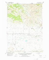
1957 Map of Blaine
USGS Topo · Published 1976About this map
Camas Prairie provides the backdrop for this mid-century survey of south-central Idaho, where the Union Pacific railroad cuts a straight line through the agricultural heart of Macon Flat. The map reveals a landscape defined by water management and grazing, with Kelly Reservoir and the Macon Sheep Bridge serving as vital infrastructure for the local economy. Small rural hubs such as Blaine and Macon anchor the region, supported by a network of educational landmarks including Springdale School and Manard Sch. To the north, the terrain rises sharply into the Sawtooth National Forest and Soldier Mountain, where the Princess Blue Ribbon Mine stands as a lone mark of industrial extraction. This transition from the flatlands to the Bennett Hills in the south illustrates the varied geography of Blaine and Camas counties during the post-war era.
Find a feature on this map
67 named features on this map. Tap any name to fly to it.
Don’t see what you’re looking for? This feature index may not catch every label — zoom into the map to look around manually.
Map Details
Editions of this 1957 Blaine Map
3 editions found
Other maps of this area

1895 · Hailey
USGS Topo · 1:125,000

1897 · Hailey
USGS Topo · 1:125,000

1900 · Sawtooth
USGS Topo · 1:125,000

1955 · Hailey
USGS Topo · 1:250,000

1957 · Fairfield
USGS Topo · 1:62,500

1957 · Thorn Creek
USGS Topo · 1:62,500

1957 · Davis Mountain
USGS Topo · 1:62,500

1957 · Bellevue
USGS Topo · 1:62,500

1957 · Blaine
USGS Topo · 1:62,500

1959 · Hailey
USGS Topo · 1:250,000