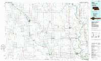
1986 Map of Blair
USGS Topo · Published 1986About this map
The Missouri River and Elkhorn River carve through this landscape of the Nebraska-Iowa borderlands, defining the agricultural and transport corridors of the mid-1980s. Major rail lines, including the Chicago and North Western and Burlington Northern, link regional hubs like Blair and West Point to the surrounding prairie. The river valleys are dotted with specialized conservation and recreation sites, such as the De Soto National Wildlife Refuge and the Dead Timber State Recreation Area north of Scribner.
Find a feature on this map
88 named features on this map. Tap any name to fly to it.
Don’t see what you’re looking for? This feature index may not catch every label — zoom into the map to look around manually.
Map Details
Editions of this 1986 Blair Map
2 editions found
Other maps of this area

1893 · Omaha
USGS Topo · 1:62,500

1893 · Fremont
USGS Topo · 1:125,000

1896 · Fremont
USGS Topo · 1:125,000

1899 · Wahoo
USGS Topo · 1:125,000

1899 · David City
USGS Topo · 1:125,000

1954 · Omaha
USGS Topo · 1:250,000

1954 · Fort Dodge
USGS Topo · 1:250,000

1955 · Sioux City
USGS Topo · 1:250,000

1955 · Fremont
USGS Topo · 1:250,000

1957 · Fremont
USGS Topo · 1:250,000