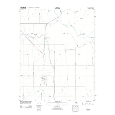
2012 Map of Blair
USGS Topo · Published 2012About this map
The town of Blair serves as the focal point of this southwestern Oklahoma landscape, where the grid of the High Plains meets the sharp topography of the Wichita Mountains. Water management is a defining characteristic of the region, evidenced by the Blair Lateral canal system that supports agriculture around the settlement. North of town, the community of City View overlooks a transition into more varied terrain. To the northeast, the N Fork Red River carves through the land, creating prominent features such as Wisdom Canyon and Devils Canyon. The northern horizon is dominated by a series of isolated peaks, including Byrd Mtn, Stewart Mtn, and King Mtn, while Cement Gap provides a natural break in the ridgeline. These rocky outcrops provide a stark contrast to the flat, section-lined farmland that stretches toward the Blair Cem and beyond.
Find a feature on this map
46 named features on this map. Tap any name to fly to it.
Don’t see what you’re looking for? This feature index may not catch every label — zoom into the map to look around manually.
Map Details
Editions of this 2012 Blair Map
This is the sole edition of this map. No revisions or reprints were ever made.
Other maps of this area

1955 · Lawton
USGS Topo · 1:250,000

1964 · Martha
USGS Topo · 1:24,000

1964 · Altus
USGS Topo · 1:24,000

1964 · Lone Wolf
USGS Topo · 1:24,000

1964 · Warren
USGS Topo · 1:24,000

1964 · Headrick
USGS Topo · 1:24,000

1971 · Blair
USGS Topo · 1:24,000

1971 · Granite
USGS Topo · 1:24,000

1971 · Hester
USGS Topo · 1:24,000

1971 · Lake Altus
USGS Topo · 1:24,000