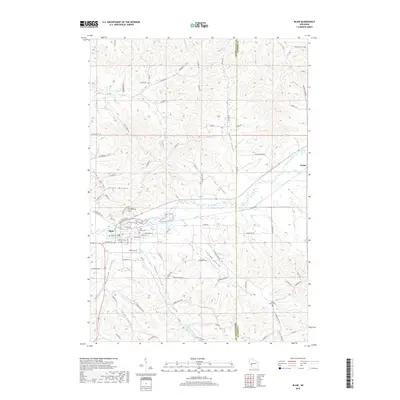
2018 Map of Blair
USGS Topo · Published 2018About this map
Blair sits at the confluence of the Trempealeau River and several significant valleys, serving as a hub for the surrounding agricultural coulee country. The landscape is defined by its dramatic relief, where narrow valley floors like Tappen Coulee and Trump Coulee are hemmed in by steep ridges such as Gransberg Hill. The settlement pattern follows these natural corridors, with roads like Larkin Valley Rd and River Rd threading through the lowlands to connect remote farmsteads to the central town site.
Find a feature on this map
88 named features on this map. Tap any name to fly to it.
Don’t see what you’re looking for? This feature index may not catch every label — zoom into the map to look around manually.
Map Details
Editions of this 2018 Blair Map
This is the sole edition of this map. No revisions or reprints were ever made.
Other maps of this area

1926 · North Bend
USGS Topo · 1:62,500

1926 · Whitehall
USGS Topo · 1:62,500

1927 · Blair
USGS Topo · 1:62,500

1929 · Whitehall
USGS Topo · 1:62,500

1929 · Galesville
USGS Topo · 1:62,500

1929 · North Bend
USGS Topo · 1:62,500

1953 · Eau Claire
USGS Topo · 1:250,000

1958 · Eau Claire
USGS Topo · 1:250,000

1964 · Eau Claire
USGS Topo · 1:250,000
1968 · Blair
USGS Topo · 1:62,500