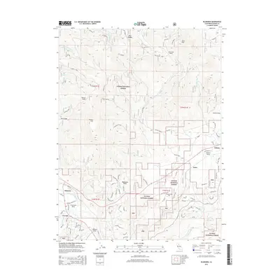
2015 Map of Blairsden
USGS Topo · Published 2015About this map
The Plumas National Forest dominates this mountain landscape, where the Middle Fork Feather River carves through the southern terrain near Blairsden. This mid-2010s survey captures a network of residential and forest roads, particularly around Graeagle and the nearby Gray Eagle Valley. The map reveals the region's historical industrial footprint through features like the Log Pond near Delleker, a remnant of the timber activity that long sustained these Sierra Nevada communities. Elevated landmarks such as Smith Peak and Penman Peak provide a topographical frame for the high valleys, including Humbug Valley and Threemile Valley. Smaller settlements like Mabie and Mohawk Vista are situated along the lower elevations, connected by routes like CR-a15 and various forest spurs such as the Willow Flat Spur.
Find a feature on this map
94 named features on this map. Tap any name to fly to it.
Don’t see what you’re looking for? This feature index may not catch every label — zoom into the map to look around manually.
Map Details
Editions of this 2015 Blairsden Map
This is the sole edition of this map. No revisions or reprints were ever made.
Other maps of this area

1890 · Sierraville
USGS Topo · 1:125,000

1891 · Downieville
USGS Topo · 1:125,000

1892 · Sierraville
USGS Topo · 1:125,000

1893 · Downieville
USGS Topo · 1:125,000

1894 · Sierraville
USGS Topo · 1:125,000

1895 · Downieville
USGS Topo · 1:125,000

1896 · Downieville
USGS Topo · 1:125,000

1897 · Downieville
USGS Topo · 1:125,000

1937 · Blairsden
USGS Topo · 1:48,000

1943 · Blairsden
USGS Topo · 1:62,500