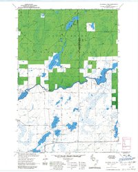
1971 Map of Blaisdell Lake
USGS Topo · Published 1985About this map
Chequamegon National Forest encompasses the northern half of this Wisconsin landscape, where the Hayward and Glidden Ranger Districts meet at the Ashland and Sawyer County line. The terrain is defined by a dense network of glacial lakes and waterways, centered on the winding East Fork Chippewa River. The presence of several recreational hubs, including the We Ha Kee Church Camp on Hunter Lake and the Glenwood Camp on Blaisdell Lake, reflects the mid-century development of this region as a destination for outdoor retreat. In the southern portion of the quadrangle, larger bodies of water like Barber Lake and Black Dan Lake are connected by smaller streams such as Boyd Creek, while a dedicated Snowmobile Trail cuts across the southeast corner near the Brunet River.
Find a feature on this map
28 named features on this map. Tap any name to fly to it.
Don’t see what you’re looking for? This feature index may not catch every label — zoom into the map to look around manually.
Map Details
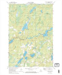
Editions of this 1971 Blaisdell Lake Map
2 editions found
Other maps of this area

1942 · Clam Lake
USGS Topo · 1:48,000

1943 · Namekagon Lake
USGS Topo · 1:48,000

1944 · Draper
USGS Topo · 1:48,000

1944 · Radisson
USGS Topo · 1:48,000

1945 · Namekagon Lake
USGS Topo · 1:48,000

1945 · Clam Lake
USGS Topo · 1:48,000

1947 · Draper
USGS Topo · 1:48,000

1949 · Radisson
USGS Topo · 1:48,000

1953 · Ashland
USGS Topo · 1:250,000

1953 · Rice Lake
USGS Topo · 1:250,000