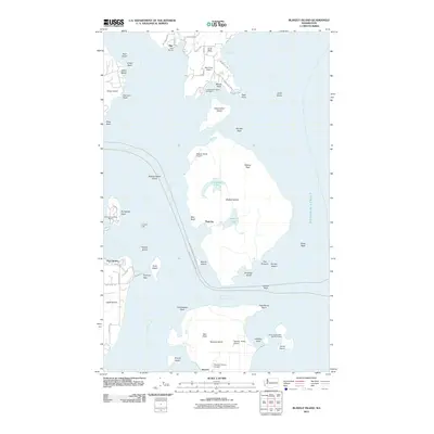
2011 Map of Blakely Island
USGS Topo · Published 2011About this map
Blakely Island and Decatur Island dominate this marine landscape in the San Juan Islands, illustrating a maritime community defined by private airstrips and isolated settlements. Small harbor communities like Olga and Decatur serve as focal points for the archipelago, while the presence of the Blakely Island Airport and Decatur- Jones Airport underscores the importance of general aviation for island access.
Find a feature on this map
68 named features on this map. Tap any name to fly to it.
Don’t see what you’re looking for? This feature index may not catch every label — zoom into the map to look around manually.
Map Details
Editions of this 2011 Blakely Island Map
This is the sole edition of this map. No revisions or reprints were ever made.
Other maps of this area

1943 · Richardson
USGS Topo · 1:62,500

1943 · Orcas Island
USGS Topo · 1:62,500

1943 · Deception Pass
USGS Topo · 1:62,500

1943 · Anacortes
USGS Topo · 1:62,500

1951 · Deception Pass
USGS Topo · 1:62,500

1951 · Anacortes
USGS Topo · 1:62,500

1957 · Richardson
USGS Topo · 1:62,500

1957 · Orcas Island
USGS Topo · 1:62,500

1957 · Victoria
USGS Topo · 1:250,000

1973 · Cypress Island
USGS Topo · 1:24,000