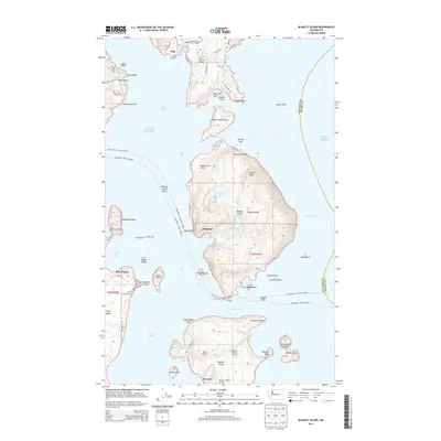
2014 Map of Blakely Island
USGS Topo · Published 2014About this map
Blakely Island and its surrounding archipelago define this maritime landscape in the San Juan Islands, where the geography of the inland sea dictates every pattern of settlement. This 2014 survey documents the isolated coastal communities of Thatcher, Decatur, and San Elmo, which rely on a network of private airstrips like Blakely Island Airport and small marinas such as Spencer's Landing Marina for connectivity. The interior of the islands remains largely undeveloped, dominated by topographical features like Blakely Peak and the freshwater Horseshoe Lake. Along the eastern edge of Lopez Island, the distinctive formation of Spencer Spit extends into the Lopez Sound, while James Island State Park sits isolated at the entrance to Rosario Strait. The map captures a moment in the modern era where ferry routes and private docks remain the primary lifelines for these Puget Sound outposts.
Find a feature on this map
78 named features on this map. Tap any name to fly to it.
Don’t see what you’re looking for? This feature index may not catch every label — zoom into the map to look around manually.
Map Details
Editions of this 2014 Blakely Island Map
This is the sole edition of this map. No revisions or reprints were ever made.
Other maps of this area

1943 · Richardson
USGS Topo · 1:62,500

1943 · Orcas Island
USGS Topo · 1:62,500

1943 · Deception Pass
USGS Topo · 1:62,500

1943 · Anacortes
USGS Topo · 1:62,500

1951 · Deception Pass
USGS Topo · 1:62,500

1951 · Anacortes
USGS Topo · 1:62,500

1957 · Richardson
USGS Topo · 1:62,500

1957 · Orcas Island
USGS Topo · 1:62,500

1957 · Victoria
USGS Topo · 1:250,000

1973 · Cypress Island
USGS Topo · 1:24,000