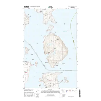
2017 Map of Blakely Island
USGS Topo · Published 2017About this map
Blakely Island dominates this portion of the San Juan Islands, characterized by its prominent inland water bodies like Horseshoe Lake and Spencer Lake. The geography of the late 2010s reveals a cluster of private and community aviation hubs including the Blakely Island Airport and Decatur Shores Airport, reflecting the essential role of air and water transport in these island communities. To the north, Orcas Island reaches down with the settlement of Olga near Buck Bay, while to the south, the community of Decatur anchors Decatur Island.
Find a feature on this map
103 named features on this map. Tap any name to fly to it.
Don’t see what you’re looking for? This feature index may not catch every label — zoom into the map to look around manually.
Map Details
Editions of this 2017 Blakely Island Map
This is the sole edition of this map. No revisions or reprints were ever made.
Other maps of this area

1943 · Richardson
USGS Topo · 1:62,500

1943 · Orcas Island
USGS Topo · 1:62,500

1943 · Deception Pass
USGS Topo · 1:62,500

1943 · Anacortes
USGS Topo · 1:62,500

1951 · Deception Pass
USGS Topo · 1:62,500

1951 · Anacortes
USGS Topo · 1:62,500

1957 · Richardson
USGS Topo · 1:62,500

1957 · Orcas Island
USGS Topo · 1:62,500

1957 · Victoria
USGS Topo · 1:250,000

1973 · Cypress Island
USGS Topo · 1:24,000