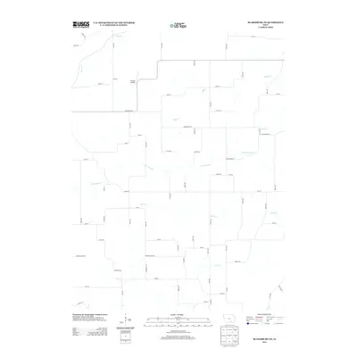
2013 Map of Blakesburg NE
USGS Topo · Published 2013About this map
Antique Airfield serves as a unique focal point in this section of rural Wapello County, Iowa, highlighting the region's aviation heritage. The landscape is defined by a dense network of watercourses, with the winding paths of Little Soap Cr, Village Cr, and Brush Cr carving through the agricultural terrain. These drainage patterns influenced the local grid of secondary roads and township lines, seen in the alignment of Bluegrass Rd and Copperhead Rd. This 2013 survey provides a clear view of the modern rural infrastructure, where naming conventions like Soap Creek Rd reflect the enduring importance of the area's natural hydrology. For those tracing local history, the proximity of Sandy Cr and Coon Cr to established farm-to-market routes offers insight into the spatial development of this part of the state.
Find a feature on this map
63 named features on this map. Tap any name to fly to it.
Don’t see what you’re looking for? This feature index may not catch every label — zoom into the map to look around manually.
Map Details
Editions of this 2013 Blakesburg NE Map
This is the sole edition of this map. No revisions or reprints were ever made.
Other maps of this area

1954 · Centerville
USGS Topo · 1:250,000

1954 · Des Moines
USGS Topo · 1:250,000

1956 · Des Moines
USGS Topo · 1:250,000

1956 · Ottumwa North
USGS Topo · 1:62,500

1956 · Ottumwa South
USGS Topo · 1:24,000

1956 · Ottumwa South
USGS Topo · 1:62,500

1956 · Ottumwa North
USGS Topo · 1:24,000

1957 · Des Moines
USGS Topo · 1:250,000

1957 · Centerville
USGS Topo · 1:250,000

1958 · Centerville
USGS Topo · 1:250,000