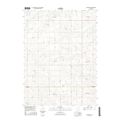
2015 Map of Blakesburg NE
USGS Topo · Published 2015About this map
Antique Airfield serves as a unique aeronautical landmark in the northwest portion of this rural Iowa landscape, set amongst a complex network of streams and family burial grounds. The terrain is deeply incised by the drainage systems of Little Soap Cr, Village Creek, and Brush Creek, which dictate the winding paths of rural routes like Soap Creek Road. Genealogy researchers will find a high density of small cemeteries scattered across the townships, including Mount Zion Cemetery, Hopewell Cemetery, and Wellman Cemetery. The southern edge of the survey captures the border between Wapello and Davis Counties, where the landscape transitions toward the winding Coon Creek valley. This map documents the persistent agricultural and commemorative layout of the region, where section lines and creek beds define the boundaries of local life.
Find a feature on this map
47 named features on this map. Tap any name to fly to it.
Don’t see what you’re looking for? This feature index may not catch every label — zoom into the map to look around manually.
Map Details
Editions of this 2015 Blakesburg NE Map
This is the sole edition of this map. No revisions or reprints were ever made.
Other maps of this area

1954 · Centerville
USGS Topo · 1:250,000

1954 · Des Moines
USGS Topo · 1:250,000

1956 · Des Moines
USGS Topo · 1:250,000

1956 · Ottumwa North
USGS Topo · 1:62,500

1956 · Ottumwa South
USGS Topo · 1:24,000

1956 · Ottumwa South
USGS Topo · 1:62,500

1956 · Ottumwa North
USGS Topo · 1:24,000

1957 · Des Moines
USGS Topo · 1:250,000

1957 · Centerville
USGS Topo · 1:250,000

1958 · Centerville
USGS Topo · 1:250,000