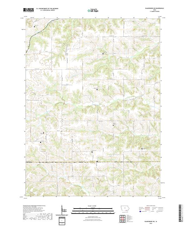
2022 Map of Blakesburg NE
USGS Topo · Published 2022About this map
Antique Airfield serves as a distinct landmark in this rural landscape north of the Wapello and Davis County line. The terrain is defined by a dense network of creek systems including Village Creek, Little Soap Creek, and Brush Creek, which carve through the Iowa countryside. This area is notably rich in small, dispersed burial grounds that speak to the long-standing agricultural community. Researchers will find numerous family-named sites such as Wellman Cem, Abegg Cem, and Denton Cem situated along the section lines and rural routes like Bluegrass Road and County Highway H47. The map illustrates how local transportation remains tied to the grid of gravel and paved roads, connecting historic landmarks like Mount Zion Cem and Hopewell Cem across the township lines of t72n r15w and t71n r15w.
Find a feature on this map
44 named features on this map. Tap any name to fly to it.
Don’t see what you’re looking for? This feature index may not catch every label — zoom into the map to look around manually.
Map Details
Editions of this 2022 Blakesburg NE Map
This is the sole edition of this map. No revisions or reprints were ever made.
Other maps of this area

1954 · Centerville
USGS Topo · 1:250,000

1954 · Des Moines
USGS Topo · 1:250,000

1956 · Des Moines
USGS Topo · 1:250,000

1956 · Ottumwa North
USGS Topo · 1:62,500

1956 · Ottumwa South
USGS Topo · 1:24,000

1956 · Ottumwa South
USGS Topo · 1:62,500

1956 · Ottumwa North
USGS Topo · 1:24,000

1957 · Des Moines
USGS Topo · 1:250,000

1957 · Centerville
USGS Topo · 1:250,000

1958 · Centerville
USGS Topo · 1:250,000