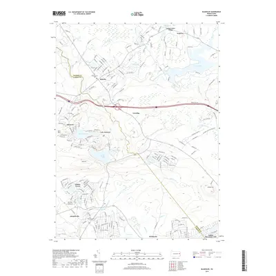
2019 Map of Blakeslee
USGS Topo · Published 2019About this map
Blakeslee and Albrightsville anchor this portrait of the Poconos, where the boundary between Monroe and Carbon Counties divides a landscape defined by resort development and glacial waterways. The map documents the dense residential networks of Locust Lakes Village, Holiday Pocono, and Indian Mountain Lake, contrasting with the more established rural centers. Genealogists will find significant value in the documentation of three local burial grounds: Blakeslee Cem, Saint Paul's Lutheran Cem, and the Old Albrightsville Cem. Water is the dominant geographic feature, ranging from the expansive Pocono Lake and Lake Harmony to the cascades of Tobyhanna Falls. The terrain is punctuated by significant elevations such as Lake Mtn and Pimple Hill, while a complex system of runs and creeks, including Tunkhannock Creek and Mud Run, drain the high plateaus between these growing mountain communities.
Find a feature on this map
164 named features on this map. Tap any name to fly to it.
Don’t see what you’re looking for? This feature index may not catch every label — zoom into the map to look around manually.
Map Details
Editions of this 2019 Blakeslee Map
This is the sole edition of this map. No revisions or reprints were ever made.
Other maps of this area

1914 · Wind Gap
USGS Topo · 1:62,500

1916 · Wind Gap
USGS Topo · 1:62,500

1919 · Pocono
USGS Topo · 1:62,500

1921 · Pocono
USGS Topo · 1:62,500

1922 · Mauch Chunk
USGS Topo · 1:62,500

1922 · Stoddartsville
USGS Topo · 1:62,500

1923 · Pocono
USGS Topo · 1:62,500

1924 · Stoddartsville
USGS Topo · 1:62,500

1924 · Mauch Chunk
USGS Topo · 1:62,500

1943 · Scranton
USGS Topo · 1:125,000
Featured Places
- Kidder Township, PA
- William Warke's Acres, Tunkhannock Township
- Pocono Pines, Tobyhanna Township
- Albrightsville, Kidder Township
- Tobyhanna Township, PA