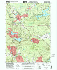
1999 Map of Blakeslee
USGS Topo · Published 2001About this map
Pocono Mountain resort life and protected conservation lands define this late 20th-century landscape at the border of Monroe and Carbon Counties. Centered on the crossroads of Blakeslee, the area shows a distinct shift toward recreation and seasonal residency, with developments like Locust Lakes Village and Pocono Lake Preserve framing the older settlements of Albrightsville and Fernridge. The southern half of the sheet is dominated by extensive public lands, including State Game Lands No 129 and portions of Hickory Run State Park, which preserve the rugged watersheds of Tunkhannock Creek and Mud Run.
Find a feature on this map
50 named features on this map. Tap any name to fly to it.
Don’t see what you’re looking for? This feature index may not catch every label — zoom into the map to look around manually.
Map Details
Editions of this 1999 Blakeslee Map
This is the sole edition of this map. No revisions or reprints were ever made.
Other maps of this area

1914 · Wind Gap
USGS Topo · 1:62,500

1916 · Wind Gap
USGS Topo · 1:62,500

1919 · Pocono
USGS Topo · 1:62,500

1921 · Pocono
USGS Topo · 1:62,500

1922 · Mauch Chunk
USGS Topo · 1:62,500

1922 · Stoddartsville
USGS Topo · 1:62,500

1923 · Pocono
USGS Topo · 1:62,500

1924 · Stoddartsville
USGS Topo · 1:62,500

1924 · Mauch Chunk
USGS Topo · 1:62,500

1943 · Scranton
USGS Topo · 1:125,000
Featured Places
- Kidder Township, PA
- Pocono Pines, Tobyhanna Township
- Penn Forest Township, PA
- Tobyhanna Township, PA
- Tunkhannock Township, PA