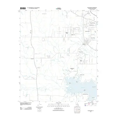
2012 Map of Blanchard
USGS Topo · Published 2012About this map
Cross Lake and its intricate northern shoreline dominate the southern reaches of this Caddo Parish landscape, where numerous landforms such as Gum Island, Twin Islands, and Bird Islands sit amidst the water. The community of Blanchard serves as a central hub, surrounded by a growing network of residential estates like North Park Estates and Hidden Acres. The transition from suburban development to rural industry is evident as the terrain moves north toward the Walnut Bayou Gas Field.
Find a feature on this map
118 named features on this map. Tap any name to fly to it.
Don’t see what you’re looking for? This feature index may not catch every label — zoom into the map to look around manually.
Map Details
Editions of this 2012 Blanchard Map
This is the sole edition of this map. No revisions or reprints were ever made.
Other maps of this area

1932 · Shreveport SE
USGS Topo · 1:31,680

1932 · Shreveport NE
USGS Topo · 1:31,680

1943 · Waskom
USGS Topo · 1:62,500

1944 · Caddo Lake
USGS Topo · 1:62,500

1945 · Waskom
USGS Topo · 1:62,500

1945 · Greenwood
USGS Topo · 1:62,500

1946 · Caddo Lake
USGS Topo · 1:62,500

1948 · Mooringsport
USGS Topo · 1:62,500

1955 · Shreveport
USGS Topo · 1:250,000
1955 · North Shreveport
USGS Topo · 1:24,000