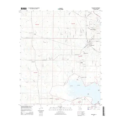
2015 Map of Blanchard
USGS Topo · Published 2015About this map
Cross Lake and its intricate northern shoreline dominate the southern reaches of this landscape northwest of Shreveport. The geography is defined by a network of waterways including Gardener Bayou, Fordney Bayou, and Page Bayou, which feed into the lake's basin around features like Gum Island and the Twin Islands. The area exhibits a pattern of established rural centers and emerging residential developments typical of the Caddo Parish outskirts during this period. Local history is anchored by the community of Blanchard and smaller settlements like Longwood, Pleasant Grove, and Shipp. Genealogists may find value in the presence of the Mount Zion Cem and Walker Hill Cem, while the road network shows the growth of suburban pockets like Dune Estates and Lakeshore North near the water.
Find a feature on this map
104 named features on this map. Tap any name to fly to it.
Don’t see what you’re looking for? This feature index may not catch every label — zoom into the map to look around manually.
Map Details
Editions of this 2015 Blanchard Map
This is the sole edition of this map. No revisions or reprints were ever made.
Other maps of this area

1932 · Shreveport SE
USGS Topo · 1:31,680

1932 · Shreveport NE
USGS Topo · 1:31,680

1943 · Waskom
USGS Topo · 1:62,500

1944 · Caddo Lake
USGS Topo · 1:62,500

1945 · Waskom
USGS Topo · 1:62,500

1945 · Greenwood
USGS Topo · 1:62,500

1946 · Caddo Lake
USGS Topo · 1:62,500

1948 · Mooringsport
USGS Topo · 1:62,500

1955 · Shreveport
USGS Topo · 1:250,000
1955 · North Shreveport
USGS Topo · 1:24,000