2024 Map of Blanchard
USGS Topo · Published 2024About this map
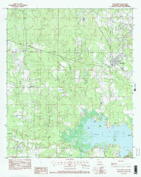
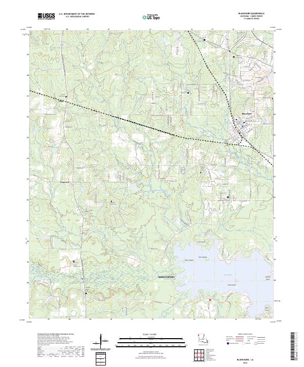
The northern reaches of Shreveport meet the transition to Caddo Parish’s timbered wetlands and growing residential pockets in this survey of the Blanchard area. The landscape is defined by the expansive waters of Cross Lake, where Bird Islands and Twin Islands break the surface, and Page Bayou feeds into the eastern shore. The town of Blanchard serves as the primary hub, situated along the Kansas City Southern railroad line. Family history is deeply rooted in the soil here, evidenced by numerous small burial grounds such as the Cole Family Cem and the multiple Bickham - Francis Marion Cem locations. The terrain is a network of bayous, including Piney Bayou and Fordney Bayou, which historically shaped the development of outlying settlements like Shipp and Longwood. Modern developments like the Blanchard Mobile Villa appear alongside older thoroughfares such as Greenwood Mooringsport Rd.
Find a feature on this map
134 named features on this map. Tap any name to fly to it.
Don’t see what you’re looking for? This feature index may not catch every label — zoom into the map to look around manually.
Map Details
Editions of this 2024 Blanchard Map
This is the sole edition of this map. No revisions or reprints were ever made.