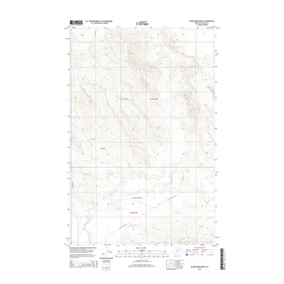
2014 Map of Blanchard Ranch
USGS Topo · Published 2014About this map
Blanchard Ranch and the surrounding rangelands of Valley County are defined by an extensive network of water management features designed for this arid Montana landscape. The terrain is dominated by the broad Archambeault Flats and a series of intermittent drainages including Willow Cr, Coyote Cr, and Sage Hen Cr. To support livestock and land use, numerous small-scale impoundments dot the drainage basins, ranging from the Aitken Reservoir in the north to the Newton Reservoir and Mud Run Reservoir in the south. The presence of Baldy Pit and the Archambeault Retention Reservoir highlights the intersection of resource extraction and water conservation efforts. This map provides a detailed view of the cadastral survey lines of Townships 26 and 27 North, Range 39 East, as they stood in the early 21st century, revealing the sparse but deliberate human imprint on the high plains.
Find a feature on this map
20 named features on this map. Tap any name to fly to it.
Don’t see what you’re looking for? This feature index may not catch every label — zoom into the map to look around manually.
Map Details
Editions of this 2014 Blanchard Ranch Map
This is the sole edition of this map. No revisions or reprints were ever made.
Other maps of this area

1943 · Glasgow
USGS Topo · 1:125,000

1954 · Jordan
USGS Topo · 1:250,000

1954 · Glasgow
USGS Topo · 1:250,000

1956 · Jordan
USGS Topo · 1:250,000

1957 · Glasgow
USGS Topo · 1:250,000

1958 · Glasgow
USGS Topo · 1:250,000

1958 · Jordan
USGS Topo · 1:250,000

1958 · Engstrom Ranch
USGS Topo · 1:24,000

1958 · Miller Coulee
USGS Topo · 1:62,500

1958 · Collins Ranch
USGS Topo · 1:62,500