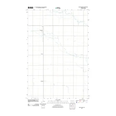
2011 Map of Blanchard
USGS Topo · Published 2011About this map
Blanchard sits at the heart of this Traill County landscape, where the prairie is defined by a precise section-line grid and the wandering course of the Elm River. This early 21st-century survey illustrates a classic North Dakota settlement pattern, with the small hubs of Preston and Greenfield spaced along the north-south transport corridor. The hydrology of the Red River Valley is prominent here, as the North Branch Elm River meanders across the northeastern corner, contrasting with the straight-line precision of County Hwy-3 and County Hwy-1. These roads connect the disparate farmsteads and agricultural plots that dominate the terrain, reflecting the enduring rural character of the region.
Find a feature on this map
9 named features on this map. Tap any name to fly to it.
Don’t see what you’re looking for? This feature index may not catch every label — zoom into the map to look around manually.
Map Details
Editions of this 2011 Blanchard Map
This is the sole edition of this map. No revisions or reprints were ever made.
Other maps of this area

1918 · Kelso
USGS Topo · 1:62,500

1943 · Kelso
USGS Topo · 1:62,500

1952 · Grand Forks
USGS Topo · 1:250,000

1956 · Grand Forks
USGS Topo · 1:250,000

1963 · Hillsboro
USGS Topo · 1:24,000

1963 · Kelso
USGS Topo · 1:24,000

1966 · Grand Forks
USGS Topo · 1:250,000

1967 · Mayville South
USGS Topo · 1:24,000

1967 · Ayr NE
USGS Topo · 1:24,000

1967 · Blanchard
USGS Topo · 1:24,000