
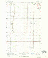
1967 Map of Blanchard
USGS Topo · Published 1969About this map
Blanchard stands as the primary settlement in this corner of Traill County, positioned along the north-south tracks of the Great Northern railroad. The landscape is defined by the agricultural geometry of the Red River Valley, where the winding course of the Elm River and its North Branch Elm River break the uniform grid of sections and townships. These natural waterways are supplemented by an engineered drainage system, including Burke Drain No 15 and Burke Drain No 16, reflecting the era's focus on land reclamation for farming. Small rail-side locales like Preston and the southern township area of Greenfield illustrate the dispersed nature of rural communities during the late 1960s. The survey also delineates civil boundaries for Bloomfield and Bohnsack townships, providing a clear view of the territorial organization that shaped local governance and land ownership in eastern North Dakota.
Find a feature on this map
12 named features on this map. Tap any name to fly to it.
Don’t see what you’re looking for? This feature index may not catch every label — zoom into the map to look around manually.
Map Details
Editions of this 1967 Blanchard Map
This is the sole edition of this map. No revisions or reprints were ever made.
Other maps of this area

1918 · Kelso
USGS Topo · 1:62,500

1943 · Kelso
USGS Topo · 1:62,500

1952 · Grand Forks
USGS Topo · 1:250,000

1956 · Grand Forks
USGS Topo · 1:250,000

1963 · Hillsboro
USGS Topo · 1:24,000

1963 · Kelso
USGS Topo · 1:24,000

1966 · Grand Forks
USGS Topo · 1:250,000

1967 · Mayville South
USGS Topo · 1:24,000

1967 · Ayr NE
USGS Topo · 1:24,000
1967 · Grandin
USGS Topo · 1:24,000