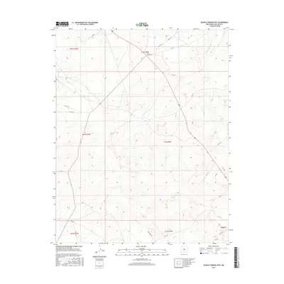
2017 Map of Blanco Trading Post
USGS Topo · Published 2017About this map
Blanco Trading Post serves as a primary geographic anchor in this arid landscape of the Eastern Navajo Agency, situated near the headwaters of the Blanco Wash. The terrain is defined by a network of drainage ways and high mesas, crisscrossed by local routes like Deer Springs Rd and Co Rd 7675. In the southeast corner, the settlement of Nageezi sits along the primary thoroughfare, marking a transition point for travelers navigating the high-desert plateau. The map detail reflects a modern era of land management and transportation, where traditional trading hubs continue to orient the rural population. Extensive township and range lines, such as t24n r9w, illustrate the systematic division of this vast territory between the Chaco and Blanco drainages.
Find a feature on this map
27 named features on this map. Tap any name to fly to it.
Don’t see what you’re looking for? This feature index may not catch every label — zoom into the map to look around manually.
Map Details
Editions of this 2017 Blanco Trading Post Map
This is the sole edition of this map. No revisions or reprints were ever made.
Other maps of this area

1889 · Largo
USGS Topo · 1:250,000

1895 · Largo
USGS Topo · 1:250,000

1954 · Aztec
USGS Topo · 1:250,000

1958 · Aztec
USGS Topo · 1:250,000

1959 · Nageezi
USGS Topo · 1:62,500

1962 · Aztec
USGS Topo · 1:250,000

1965 · Aztec
USGS Topo · 1:250,000
1966 · Pueblo Bonito NW
USGS Topo · 1:24,000

1966 · Lybrook NW
USGS Topo · 1:24,000
1966 · Huerfano Trading Post SW
USGS Topo · 1:24,000